
Polygon Annotation Services
What Is Polygon Annotation in Computer Vision?
Polygon annotation is a process of plotting x and y values along the edges of an object to get its shape or outline. It forms an accurate border that fits the target tightly, eliminating the whitespaces or background pixels. The visual noise elimination is used to allow computer vision models to identify abnormal shapes in the real world with high accuracy. It becomes especially necessary when training AI models on complex visual tasks, when the ultimate form of the object defines the performance of the model.
The key aspects of polygon annotation are:
- Vertex Mapping
- Edge Sealing
- Pixel-level Detail
- Noise Elimination
Our agency employs a team of skilled professional annotators who provide high-quality Polygon Annotation Services for intricate visual tasks. We perform best in niche industries where other tools fail to work, like mapping rooftops in urban development or examining intricate organic structures. Our human-controlled accuracy will make your AI models identify irregular shapes in various datasets with all details. Reach out to our team to learn more about these data annotation services.
What Are the Different Types of Polygon Annotation Services?
We are familiar with the different kinds of Polygon Annotation Services, which are:

AERIAL AND SATELLITE MAPPING
It focuses on mapping irregular geographical features via image annotation polygon techniques, where traditional bounding boxes add too much irrelevant background data. We map the precise shapes of roofs, trees, and water bodies to assist the drone and satellite models in the localization of objects in a very fine spatial resolution. This provides precision in city planning.

PERCEPTION PRECISION IN AUTO VEHICLES
Self-driving cars demand pixel-perfect information in order to tell the difference between people, vehicles, and complicated road hazards. Semantic segmentation polygon tasks are used to perform the precise outline of objects without any whitespace. This accuracy increases situational awareness of the vehicle, whereby, in real-time, the model can effectively filter out environmental noise.

AGRICULTURAL PATTERN RECOGNITION
Polygon annotation object detection is used in precision farming to detect the boundaries of crops, plant health, and livestock location with high precision. The data allows machine learning models to conduct specific aerial surveillance and precision spraying through the capture of the exact silhouettes of biological assets. It assists in the better management of fields to increase crop yields.

MEDICAL IMAGING AND ANALYSIS
Standard shapes cannot always capture and outline complex shapes of biological structures, such as tumors or internal organs. Polygon annotation offers the appropriate level of detail that enables healthcare AI to extract MRI or X-ray data and interpret it with precision. Our team makes sure that all abnormal cells or tissue margins are mapped to help in diagnostic automated instruments.
TRACKING VIDEO OBJECTS
Tracking irregular objects in motion requires frame-by-frame polygon masking to maintain boundary integrity. The polygon annotation computer vision method is crucial to security surveillance and sport-tech analytics, where the models need to distinguish among overlapped targets. We maintain target shape across frames to reduce drift and improve tracking.

CATALOG MANAGEMENT
Special e commerce annotation labeling services aim at identifying the outline of irregular retail products in e-catalogs and augmented reality. Models can locate products in the context of clutter in the background and light by isolating the shape of the exact item. This creates a seamless shopping experience by training models to recognize products accurately.
Why Choose Us for Polygon Annotation Service?
95% Accuracy Guaranteed
We work to ensure over 95% precision across all your annotations. You can place an order to get a free sample of the data before making the final payment.

Reasonable Prices
We provide transparent pricing that sets us apart from other annotation companies. You will receive high-quality data at reasonable rates with no hidden charges.

24/7 Support
Our team is available 24/7 to provide support and handle your digital visual assets. Call us at any time for a project update or technical discussion.

Dedicated Project Managers
You will not have to wait for an update. We assign dedicated project managers to every project to ensure you receive real-time updates and seamless communication.

Tailored Solutions
Share your needs, and we will provide custom solutions using the right types of polygons. Explain your model’s purpose, and we will adapt our technique accordingly.

Timely Delivery
We deliver quality datasets on time. We utilize advanced Processing workflows and expert human reviews to ensure your deadlines are always met.

Data Security
We have very strong security systems to keep all information secure. We are a GDPR-compliant partner providing secure and ethical polygon data labeling.
All Types Covered
From urban mapping to biological imaging, we provide detailed outlines for all visual AI tasks. Contact us to talk about your project and place an order.
Which Industries Use Polygon Annotation for Machine Learning Models?

INDUSTRIAL ROBOTICS
Robotic forklifts and self-driving warehouse machines are also based on strict visionary data to move safely over a cluttered floor. These robots can recognize single packages, pallets, and dangerous obstacles through masterful segmentation. The high-fidelity training data enables automated systems to tell the difference between stationary equipment and moving objects to maximize operational efficiency.

MARITIME AND PORTS
The shipping industry in the international ports uses Image annotation services to track the cargo and loading of a ship. Proper polygon detection is necessary to recognize the hulls and containers of ships in the complicated reflections and the harbor waves. Clear image information assists authorities in controlling traffic and docking space and goes a long way in minimizing logistical delays in international commerce.

URBAN INFRASTRUCTURE
To measure infrastructure degradation, cities require anomaly detection. These include cracks in pavement and broken power lines. Civil engineers map structural abnormalities using professional polygon annotation services. These solutions remove unwanted background noise from the data. Maintenance crews can then precisely locate the damage areas, ensure accurate monitoring, and perform faster infrastructure maintenance.

ENVIRONMENTAL CONSERVATION
These techniques are employed by specialized humans to establish species when studying biodiversity, and are useful in teaching models to enumerate animals in thick foliage. These efforts are supported by our Data Classification Services, which provide accurate masks of fauna in high-density places. This enables the scientists to monitor the population dynamics in large and unexplored wilderness areas.

FASHION AND APPAREL
Deep learning algorithms power virtual fitting rooms effectively. They require exact clothing silhouettes to overlay fabrics on avatars. We provide precise masks for accurate garment editing. These specialized services help brands improve buyer confidence significantly. They also help reduce high product return rates.

GEOSPATIAL REAL ESTATE
Advanced machine learning models detect non-standard property assets. They identify garden sheds, patios, and other additions. We use high-resolution photos to map boundaries and features. Our mapping captures all landscape improvements accurately and clearly. These precise datasets allow platforms to recognize polygons correctly.

Security and Surveillance
We use audio annotation software to annotate data for AI speech recognition systems and audio event detection. It helps in proactive monitoring, identifying threats, and improving response time for safety and law enforcement applications. We can provide scalable audio annotation solutions to help you with your security and surveillance.

Smart Devices and IoT
We deliver precise audio annotation of voice commands and environmental sounds to improve response time and accuracy of smart assistants and connected devices. Consequently, it helps improve user convenience and automation capabilities.

Sports and Games
Availing our audio labeling services helps identify player actions, crowd interactions, and commentary to improve sports analytics. This also helps highlight generation and get a more immersive gaming audio experience.
Our Polygon Annotation Process
1. Sample Data Annotation
The first step of our data annotation process is to label a sample visual file. This ensures the workflow aligns with technical guidelines. It also initiates the quotation process. This step helps in:
➤ Identifying specific visual edge cases
➤ Integrating feedback from the project lead
➤ Getting approval from the client before full project deployment
2. Annotation and Labeling
Once guidelines are established, we perform the actual segmentation and labeling. This is done through our expert services by:
➤ Assigning tasks to our manual polygon annotation specialists
➤ Using precision tools for accurate shape outlines and labeling
➤ Maintaining continuous communication with project managers
3. Multi-Layered Quality Assurance
We are dedicated to providing superior solutions. Every outline goes through a rigorous, multi-layered quality review process:
➤ Technical peer review
➤ Specialist admin review
➤ Geometric consensus and validation
4. Secure Delivery and Feedback Integration
The training sets are delivered on time. They provide scalable solutions for your projects. Professional services are offered to support your ongoing data annotation needs.
➤ Securing the safe transfer of high-quality polygon datasets
➤ Supporting various file formats, including JSON, COCO, and PNG
➤ Improving pixel-level segmentation through feedback-based solutions and follow-up services.
Our Success Stories and Use Cases

Automating Crop Health Monitoring with Polygonal Annotation
…
We are thoroughly impressed with the level of accuracy AnnotationBox’s Polygonal Annotation has brought to our crop health monitoring process.
‘The automation of aerial image annotation has allowed us to identify issues like pest infestations and water stress far more efficiently, resulting in better yields and reduced resource waste.’
– Mark R. Anderson, Chief Agricultural Officer
Read the full case study
Know more

Improving Autonomous Vehicle Navigation Through Geospatial Annotations
…
Partnering with AnnotationBox has revolutionized our autonomous vehicle training pipeline. Their high-precision geospatial annotations enabled our systems to better recognize lanes, obstacles, and environmental variables in real-time, even under difficult conditions like fog, nighttime, and rural roads.
‘Thanks to AnnotationBox, we saw a major improvement in obstacle detection and route optimization, pushing our vehicle safety standards ahead of industry expectations. Their scalable, accurate solutions have been critical to our product success.
’
– Ryan Mitchell, CTO, DriveSense Technologies
Read the full case study
Know more

How AnnotationBox is Improving Self-Driving Car Safety with Image Recognition System
…
Machine learning is the key to making self-driving cars a reality. It allows us to develop algorithms that can learn from large amounts of data, making it possible for autonomous vehicles to understand the complexities of the road and make safe, informed decisions.
‘As we strive to expand and explore the boundaries of AI and machine learning, we’re getting closer and closer to a future where self-driving cars are the norm, transforming transportation as we know it.’
– Dr. Raquel Urtasun, a leading researcher in the field of self-driving cars and machine learning.
Read the full case study
Know more
Frequently Asked Questions
What Tools Are Used for Polygon Annotation?
Polygon annotation utilizes point-based tools, brush-like tools, and algorithmic tools. Manual point-based methods involve plotting individual vertices. This approach ensures maximum precision. Brush-like tools allow rapid tracing of irregular silhouettes. They are useful for complex shapes. Algorithmic tools rely on edge-detection techniques. These techniques generate polygons automatically. This process speeds up production while maintaining annotation accuracy.
What Types of Data Can Be Annotated with Polygons?
We label a large variety of visual images. These include medical imagery, satellite images, and aerial images. This labeling supports a wide range of computer vision projects.
How Is Polygon Object Boundary Labeling Performed?
The process of polygon annotation involves using specialized labeling software. This software maps vertices according to the specific lines of a target. Once the boundaries are clearly defined, each shape is assigned a class label. This step transforms raw imagery into a structured and usable dataset.
What Is the Purpose of Using Polygon in Image Annotation?
The main aim of polygon annotation as an image annotation tool is to draw precise, multi-sided contours. These contours define difficult and irregular shapes. This approach provides pixel-level precision. It is required to train high-performing computer vision models. These models support critical industries such as autonomous driving and medical diagnostics.
When Is a Polygon vs. a Polyline Annotation Used?
Polygon annotation is best used to record the entire shape and surface area of irregular objects. These objects can include anatomical structures, vegetation, or detailed architecture. Polyline annotation is used differently. It is employed only to follow linear objects such as power lines, road markings, or pipelines. Polylines trace paths. Polygons determine the precise geometric volume of an object.
How Is Quality Maintained in Polygon Boundary Mapping?
Perfection is ensured through a multi-level checking system. This system integrates advanced automated checks and manual reviews. Professional human auditors support the process. All coordinates are verified carefully. This guarantees correct vertex placement. It also ensures boundary consistency in accordance with high industry standards.
What Are the Pros and Cons of Polygon Annotation?
Advantages: Polygon masks are used for irregular forms. They provide pixel-perfect precision by removing unnecessary background pixels from images or videos. This high-fidelity method ensures that models are trained on the exact geometry of an object. It prevents the models from receiving distracting noise, improving accuracy and performance.
Disadvantages: Polygon annotation is more time-consuming than regular bounding boxes. Certain tools struggle with complex tasks. Examples include forming internal donut holes or connecting parts of the same object across an image when segments are incomplete. These technical challenges can slow down annotation for intricate projects.
What Is the Difference Between Manual and Automated Polygon Annotation?
Manual annotation is a process in which human specialists plot vertices manually using high-precision interfaces. They take necessary care to ensure the highest quality for complex shapes. Tools that allow freehand drawing and zooming assist this process. Although time-consuming, manual annotation provides the most accurate ground truth.
Automated annotation uses algorithms such as Mask-RCNN to pre-label polygons. This approach saves significant time in the annotation process. However, automated results are usually followed by a human-in-the-loop checkpoint. Humans refine complex boundaries and correct algorithmic errors. This ensures accuracy for high-stakes AI applications.
What Are the Challenges of Scaling Polygon Annotation In-House?
- Scaling polygon projects internally consumes significant labor. This can create serious bottlenecks for AI team operations.
- Accurate hand placement of vertices greatly increases project timelines as data sizes grow.
- Annotators must be trained and sourced specifically to handle complex and irregular shapes.
- Advanced software with snapping and validation features is costly to develop or license.
- Without a multi-layer review process, labeling errors occur. These errors negatively impact model accuracy and performance.
What Are the Benefits of Outsourcing Polygon Annotation?
Outsourcing offloads the workload to specialty partners. These partners deliver high-precision data. This allows your team to focus on AI development. Benefits are:
- Immediate Expertise Access: Work with specialists who are trained in complex, industry-specific labeling. They ensure high precision in geometric annotations.
- Faster Delivery: Scale effortlessly to process large datasets far quicker than in-house teams.
- Cost Optimization: Reduce expenses by avoiding recruitment, training, and infrastructure overhead.
- Elastic Scalability: Adjust workloads instantly without local hiring limitations.
- Built-In Quality Assurance: Maintain consistent, pixel-level perfection through multi-stage reviews.
- Enterprise-Grade Security: Protect sensitive data within compliant, globally regulated environments.
- Tool-Agnostic Integration: Seamlessly align with existing ML pipelines and proprietary platforms.
- Accelerated Innovation: Free your data scientists to focus on model development and optimization.
How Does High-Precision Polygon Labeling Improve the Overall ROI of an AI Project?
Precision labeling directly impacts your bottom line. It reduces the need for model retraining and troubleshooting. By providing pixel-perfect boundaries, AnnotationBox ensures higher model accuracy. It also enables faster deployment cycles. This efficiency lowers long-term compute costs. It accelerates time-to-market. As a result, it delivers a significantly higher return on your R&D investment.
How Much Does a Polygon Annotation Project Cost?
Pricing is determined by the complexity of shapes. It also depends on the density of vertices per object. Additionally, the total volume of the dataset affects pricing. Unlike flat-rate services, AnnotationBox offers a transparent cost structure. Pricing is tailored to your specific precision needs. This includes simple geometric shapes or intricate, high-vertex contours. It allows you to scale your budget efficiently. It also helps avoid high overhead costs for internal staffing and infrastructure.
Our Latest Blogs
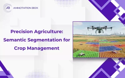
Precision Agriculture: How Semantic Segmentation Transforms Crop Management
Modern farming faces many challenges, including feeding a growing global population while...

Comparing Manual vs Automated Image Annotation: Which Is Better in 2026?
In the ever-evolving landscape of artificial intelligence, one crucial application stands out -...

Semantic Segmentation vs Instance Segmentation: Key Differences
Semantic segmentation vs Instance Segmentation are two approaches in computer vision that allow...