Satellite imagery has quietly transformed how we understand, manage, and protect our planet. From tracking urban growth to predicting crop yields and responding to disasters, the view from space is now an indispensable part of modern life. Let’s explore – What is Satellite Imagery?
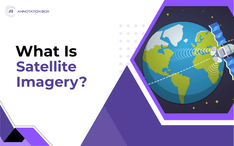
Satellite imagery is a valuable and reliable technology that provides detailed images of our planet, the Earth and other planetary bodies by capturing data from satellites orbiting the planet.
Unlike ground-based cameras, satellites offer a sweeping, bird’s-eye perspective, capturing vast and often inaccessible regions in a single shot. Moreover, various other technologies enhance the image quality, while modern processing methods convert raw data into actionable insights.
A key form of this technology is geospatial satellite imagery, which refers to images of the Earth’s surface that are tied to specific geographic coordinates. These images offer comprehensive visual data for purposes such as precision farming, telecommunication and navigation, infrastructure development, and more.
When combined with geospatial technologies like GIS (Geographic Information Systems), they allow for highly accurate analysis of spatial patterns and changes over time.
But how does it work, what are the types of imagery, and why does it matter so much today?
Now, we have learn about what satellite imagery is. Let’s first explore how satellite imagery serves numerous purposes across different sectors.
Transformative Applications of Satellite Imagery
Satellite Image Processing Applications are reshaping countless industries and fields. Here are the major 5 uses of Satellite images:
Natural Disaster Response

Following a natural disaster, Satellites quickly show damage after floods, storms, or earthquakes, helping rescuers know where to go first. In addition, it helps assess the extent of damage, identify safe zones, plan rescue operations, and monitor weather conditions that may impact response efforts.
For instance, NASA’s Earth Science Division uses satellite data regularly to assess disaster zones and, in turn, guide emergency response.
Did you know that during Hurricane Harvey in 2017, rescue teams used satellite images to see which neighbourhoods in Texas were most flooded? With this broad overview, emergency workers could quickly find the hardest-hit areas and send help where it was needed most, saving lives and speeding up recovery.
Agriculture

Farmers use satellite pictures to check the health of their crops, spot diseases early, and water their fields more effectively. Also, to assess soil conditions, predict crop yields, and track weather patterns that affect farming efficiency. This is a general practice followed in precision agriculture.
The Copernicus program in the EU is a modern technology that allows farmers to watch crops very closely, almost as if we’re watching them in real time. This helps farmers make better decisions, which can lead to bigger harvests and more sustainable farming practices.
Urban Planning and Mapping

City planners use satellite images to create accurate and updated maps for cities, land use, and track large-scale changes such as urban expansion, deforestation, or shifts in population density and infrastructure planning.
In addition, governments use satellite data for resource management, environmental observing, policy making, and ensuring compliance with regulations
Quick Update: Recently, NASA has released new satellite maps that help city planners see how cities are growing and changing. For example, NASA’s Black Marble and Landsat programs give planners up-to-date images to track new buildings, roads, and green spaces. This helps cities plan better for the future and make sure there’s enough space and resources for everyone.
Crime and Security & Military and Defence

The military uses satellites to watch important locations anywhere on Earth and gather information for security. Satellites capture high-resolution images of country borders, military bases, missile sites, naval fleets, and other strategic assets. As a result, this helps the military detect troop movements or any suspicious activities.
For example, during the Russia-Ukraine conflict, satellite photos helped people see where soldiers and tanks were, so they could know if reports about army movements were true.
Furthermore, satellite imagery also supports law enforcement by enabling surveillance, mapping crime scenes, illegal activities, and gathering evidence to help prevent and investigate crimes
Monitoring Environment, Climate Research, & Meteorology

Scientists use satellite imagery to monitor deforestation, observe melting ice, track weather patterns, and protect wildlife. Weather experts use satellite images to watch storms, study weather, and learn about climate change and natural phenomena like glaciers and desertification.
The below activities fall under environmental imagery:
Oil and Gas Exploration
Detecting seismic lines, well locations, offshore oil seepage, and surveying geological structures.
Geothermal Energy
Tracing geothermal features like hot springs and geysers to identify drilling sites.
Oceanography
Tracking sea temperatures, ocean wave patterns, marine ecosystems, and supporting fisheries management.
Biodiversity Conservation
Surveying habitats and tracking endangered species to aid conservation efforts.
In recent years, new satellites like Sentinel-2 (launched by the European Space Agency), Landsat 9 (launched by NASA and the US Geological Survey), and Pléiades Neo (launched by Airbus) have started taking very clear pictures of Earth from space.
Because of this, scientists and conservationists can now keep a closer watch on forests, rivers, and wildlife, which makes it much easier to protect nature and the environment.

What Are The Other Satellite Imagery Examples?
Mining and Exploration
Satellite imagery helps find new mineral deposits, map mining sites, and monitor the environment around mines.
Educational and Scientific Research
Providing rich data for advancing environmental science and global development studies.
What Are The Types of Satellite Imagery?

Optical Satellite Imagery
Captures images using visible and infrared light, similar to photographs.
For example: Mapping, city design, and environmental tracking
Multispectral Imagery
Captures data in several broad spectral bands, including those beyond human vision.
For instance: Vegetation analysis, topographical cover classification, agriculture
Hyperspectral Imagery
Collects data in hundreds of narrow, contiguous spectral bands for comprehensive material analysis.
To illustrate: Pollution detection, precision farming, mineral exploration
Radar Satellite Imagery
Uses microwave signals, allowing imaging through clouds and at night, making it useful for weather and atmospheric observation.
Such as: Topography, disaster response, terrain mapping
Synthetic Aperture Radar (SAR)
Specifically, an active sensing technique measures microwave reflections for high-resolution images.
Like: Subsidence assessment, disaster response, surface deformation
Interferometric SAR (InSAR)
This method combines multiple SAR images to detect and measure ground movement and surface deformation over time.
In particular: Tectonic activity, landslide monitoring, and tracking subsidence
Thermal Infrared Imagery
Detects heat emitted from the surface of the Earth, revealing temperature variations.
For example: Urban heat mapping, wildfire detection, and energy efficiency
LiDAR Satellite Imagery
Uses laser pulses to measure distances, creating precise 3D models of the surface of the Earth.
An example of this is: Terrain modeling, forest management, city planning
What Are The Kinds Of Satellite Images?
Panchromatic Images
High-resolution black-and-white or grayscale image capturing a wide range of wavelengths in a single band.
Use cases: Comprehensive mapping, urban planning, infrastructure analysis, and change detection
True Color Images
Combines red, green, and blue visible bands to replicate how the human eye perceives the terrain of Earth.
Use cases: Visual analysis, land use mapping, forestry, agriculture
False Color Images
Uses non-visible spectral bands assigned to visible colours to highlight features not seen in actual colour.
Use cases: Vegetation health monitoring, environmental studies, land cover classification
In addition to the above 3 main types of images, there are several other forms of satellite imagery, such as infrared images, visible images, water vapor images, oblique images, motion images, and stereo images.
Why Is Satellite Imagery Used?

Satellite imagery, characterized by its high-resolution imaging of the earth’s surface, is an invaluable resource for conducting spatial analysis and satellite imagery in a GIS. These images captured by satellite sensors enable a detailed examination of both the natural and built environments, offering insights that might be obscured at ground level and surpassing the capabilities of traditional paper maps and satellite imagery.
The role of Geospatial Annotation Services in this context is crucial, as they enhance the analysis of satellite imagery by providing precise labeling and identification of features within the data. This practice underscores the significance of Geospatial Data Tagging, which enriches the imagery with contextual information, facilitating more accurate interpretations and decision-making in various fields like urban planning and environmental monitoring.
Remote sensing change analysis is a pivotal component of satellite image analysis, permitting the ongoing assessment of environmental transformations, urban expansion, and other dynamic occurrences over time. This analysis is bolstered by applying deep learning techniques, which automate the detection of intricate patterns and temporal changes with a high degree of precision.
Visible imagery is particularly adept to show clouds and monitor vegetation health, while detecting water vapor through satellite imagery is essential for meteorological studies and climate research. The raster data derived from satellites, presenting the surface of the Earth in a in-depth grid format, is integral to a spectrum of analyses, such as hydrological modeling, disaster response, and efficient resource management.
In essence, the imaging of the earth conducted by satellites in various orbital paths is a cornerstone for a multitude of applications, ranging from weather forecasting to military intelligence. Integrating Geospatial Annotation Services and the strategic significance of Geospatial Data Tagging is transformative, enhancing our ability to understand and interact with the complex dynamics of the planet’s surface.
What Are The Advantages Of Satellite Imagery?

- First, they can capture images of large and distant areas worldwide.
- Additionally, they provide consistent, regular data over time to track changes.
- Compared to other methods, satellite imaging is more cost-effective than drones or planes.
- Moreover, it is safer, as satellites operate from space without risk to people.
- In addition, satellites provide a large quantity of old images. And, if we anlayze these old images, we can see how the Earth has evolved from the past.
- They also provide extensive coverage and frequent observation of remote or inaccessible areas.
- Furthermore, satellites offer a tool for aerial mapping and visual analysis at a global scale.
- They enable the detection and identification of features and events that are not visible from the ground.
- Finally, they support the management and forecasting of environmental and atmospheric phenomena.
Let’s read about:
How Does Satellite Imagery Work?
The below satellite imagery workflow will explain it well:

A. Data Acquisition
- Satellites orbit the Earth in various paths, such as polar orbits (passing over the poles) or geostationary orbits (remaining fixed over one location).
- These satellites have advanced sensors that can detect different parts of the electromagnetic spectrum, which includes visible light, infrared, ultraviolet, and microwave radiation.
- These satellites produce high-resolution images of the surface of Earth from hundreds of kilometres above the surface.
- Once collected, satellites transmit the raw data back to ground-based stations on Earth for processing, including correction for atmospheric interference and alignment with geographic location.
In the context of Data Acquisition, it is important to know about:
How Sensors on Satellites Capture Earth’s Images?
Satellites capture images of Earth by using sensors that measure electromagnetic radiation either reflected from or emitted by the planet’s surface. Specifically, passive sensors detect natural sunlight reflected from Earth, while in contrast, radar and other active sensors emit signals and detect the reflection that comes back.
The data from various wavelengths is then combined to produce images showing weather, land cover, and environmental changes.
B. Data Processing (Pre-processing)
- The raw data then undergoes a quality control check, during which corrections are made for atmospheric, geometric, and radiometric distortions to ensure accuracy and reliability.
C. Satellite Image Annotation
- Once satellite images are processed, Annotators label or mark specific features within the processed satellite images (e.g., roads, buildings, crop types).
- As a result, this step creates structured, labeled datasets essential for training machine learning models, validating automated analysis, and supporting manual examination.
- Moreover, it is especially critical for high-precision applications like mining, military, government, weather patterns, etc.
- This stage often involves advanced image segmentation services, which divide images into meaningful regions for precise analysis.
D. Satellite Data Analysis and Interpretation
Satellite Data Analysis
- The annotated and processed data is analyzed using various techniques, including image classification, change detection, and feature extraction.
- Analysis can be manual, semi-automated, or fully automated using machine learning and AI. These tools can detect patterns, track changes over time (like urban growth or deforestation), and even spot early signs of natural disasters.
- Automated analysis makes it possible to handle much more data, much faster, and with greater accuracy than manual methods.
- AI also improves GIS applications by making image analysis faster and more accurate.
Did you know the European Space Agency (ESA) uses artificial intelligence to help scientists quickly analyze satellite pictures? It’s now much easier to spot important changes in nature and the environment using images from space.
Satellite Data Interpretation
- After data analysis, the results are interpreted to extract actionable insights and information, such as land cover classification, damage assessment, or resource mapping.
- This process involves understanding the analyzed data in the application context. It often involves using visualization tools and domain expertise to support decision-making.
- Furthermore, the analysis of the composite images enables users to interpret details, track changes, and forecast event outcomes.
F. Data Application
- The results gained from the dataset insights or interpreted information are applied to real-world problems.
Why Is Annotation Essential In Satellite Imaging?
Enables Machine Learning: Annotated datasets, often provided by specialized data annotation services, are foundational for training and validating AI and computer vision models, which automate feature recognition and change detection.
Improves Accuracy: When images are labeled carefully by hand or with some automated help, the information we get is much more precise. This is crucial for critical tasks like responding to disasters or planning infrastructure.

Supports Diverse Applications: It helps us identify many different types of information in satellite images, such as land use, roads, buildings, environmental changes, and more.
End Keynote
In summary, satellite images help us see and understand our world better. As technology continues to improve, we will find even more ways to use it in our daily lives and to make smart decisions.
Frequently Asked Questions
What is the main benefit of using satellite imagery in daily life?
Satellite imagery helps monitor weather, agriculture, and traffic in real-time.
Can satellite imagery show changes over time?
Yes, satellite imagery captures land and environmental changes over weeks, months, or years.
Is satellite imagery used in disaster management?
Absolutely, satellite imagery helps assess damage and guide rescue efforts quickly.
How accurate is satellite imagery today?
Modern satellite imagery offers high resolution for detailed observation of Earth’s surface.

Her extensive experience in developing and implementing innovative AI solutions has made her a thought leader in AI. Trinity’s expertise
in machine learning and natural language processing has led her to work on various projects: from chatbots to autonomous vehicles.
Want To See My Profile — Click Here Trinity Tyler
- What is Satellite Imagery? Tap the Power of Seeing from Above - June 12, 2025
- A Deep Dive into the Meaning of Handwritten Text Recognition with OCR - February 27, 2025
- How Text Annotation Adds Depth to Reading - April 4, 2024